Table of Contents (click to expand)
Scientists believe that the Grand Canyon was formed over the course of millions of years by the Colorado River. The river was diverted by the Kaibab Plateau, which formed in the middle of the river’s flow. The river split into two parts, with one part flowing into the Gulf of Mexico and the other part forming a huge lake. The lake eventually drained, forming the Grand Canyon.
The Grand Canyon was not formed by a single event in history, but over the course of millions of years. Scientists and geologists believe that there was no canyon in that area around 35 million years ago. The Colorado River flowed across a vast plain. Around the same time, the Kaibab Plateau started to appear right in the middle of the river’s flow. Since the water couldn’t pass over or through the plateau, the river’s course was diverted.
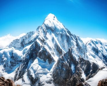
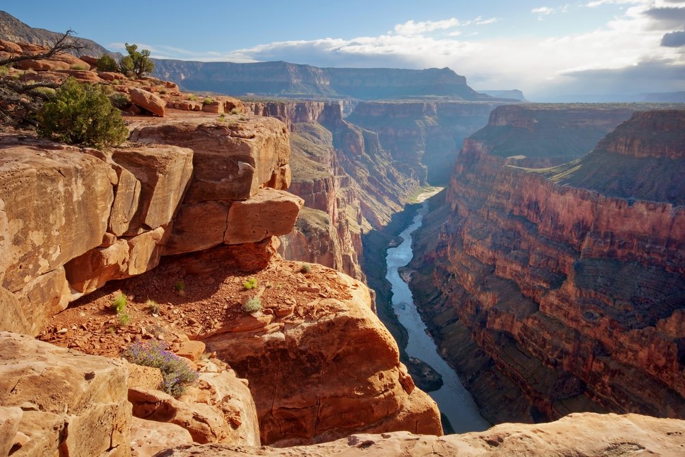
The Grand Canyon in Arizona, US, which contains part of the Colorado River, is a world-famous destination that showcases an unbelievable geological timeline of the world stretching back millions of years. It is a fantastic manifestation of the artful work that nature performs on the surface of Earth – and even beneath it! Thousands of tourists visit this massive canyon every month, making it one of the most popular tourist destinations in the United States.
Let’s take a closer look at how The Grand Canyon was formed.
Recommended Video for you:
A Million-Year Journey
The Grand Canyon was not formed by a single event in history, but over the course of millions of years, which shaped the rocks into the majestic forms and curves we see today. Although scientists have not been able to establish a concrete theory regarding the timeline of formation for the Grand Canyon, almost 35 million years ago, there was no canyon in that area. The Colorado River flowed across a vast plain (its course today is quite similar to the one that existed millions of years ago, but it happens quite a bit lower). Around the same time, the Kaibab Plateau started to appear right in the middle of the river’s flow. Since the water couldn’t pass over or through the plateau, the river’s course was diverted.
Also Read: Can All Rivers Form A Grand Canyon?
The Colorado River Course Change
The river actually split into two parts. The part of the river to the right side of the plateau (see the image below) was diverted in a southeastern direction and began flowing into the Gulf of Mexico, rather than into the Pacific Ocean, where it flowed before the Kaibab Plateau began rising. The left side of the river continued to be a drainage system for the plateau itself and the regions surrounding it on the western side.
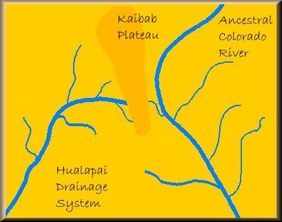
Then, approximately 12 million years ago, the flow of the eastern section of the river became blocked and then started forming a huge lake as water continued to accumulate due to a lack of an outlet. This lake is known as Lake Bidahochi.
Erosion Steps In
Even the toughest of rocks cannot stand constant weathering of their surface, resulting in erosion by various agents. In this case, the Kaibab Plateau’s western flank (near the bottom where the river was in constant contact with it) was weakened by a process known as ‘headwater erosion.’ As this process continued, the base of the plateau became weaker and weaker as time passed. Ultimately, it gave way and water broke through the barrier that had been created by the Kaibab plateau and rejoined the original course of the ancestral Colorado River.
As a result, the river assumed a new course (which was quite similar to its original one) due to favorable terrestrial conditions, and Lake Bidahochi lost much of its water. The drainage of the lake through the course of the river resulted in the formation of a gorge through which the Colorado River still flows today.
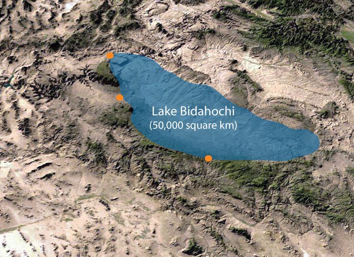
When both these sections of the Colorado River joined forces, their course became wider and deeper and lo and behold! The Grand Canyon was formed! The space that was vacated after Lake Bidahochi drained out was occupied by the Little Colorado River drainage system.
This is just the basic outline of millions of years of erosion and environmental alterations that resulted in the formation of the Great Canyon. There were a host of other factors that also played a part in this entire process, including vulcanism, continental drift, and slight variations in the Earth’s orbit (which in turn causes variations in seasons and climate).
Therefore, next time you find yourself gazing at this majestic piece of natural beauty, consider that you are witnessing not just a gigantic structure, but millions of years of Mother Nature at her most artistic!
Also Read: Why Are There So Many Canyons In US Deserts?